
Southern Corridor Selected Alternative
The Selected Alternative, as approved in the Record of Decision, is shown in the map below. This map uses the County road maps in the Study Area. You may access detailed views of this map by clicking on the portion of this map in your area of interest.
A second map shows a simplified version of the Project Study area.
Detailed Map
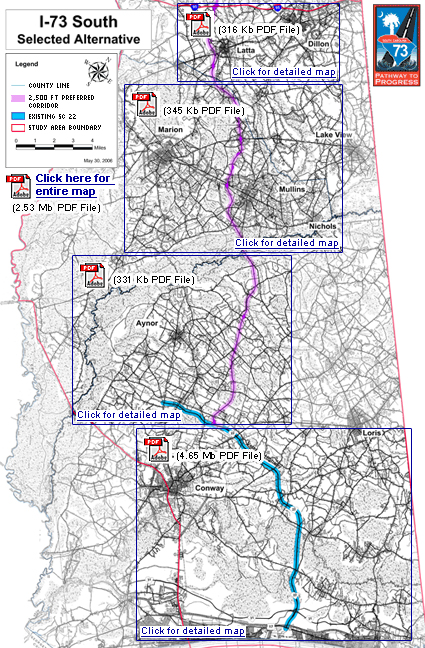
Entire Corridor Map ( 2.57mb PDF file)
Latta/Dillon Map Detail (370kb PDF file)
Marion/Mullins Map Detail (400kb PDF file)
Aynor Map Detail (386kb PDF file)
Conway/Myrtle Beach Map Detail (515kb PDF file)
Abstract Map
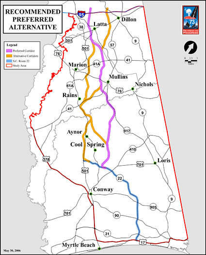
Abstract Corridor Map ( 615kb PDF file)

Property of the South Carolina Department of Transportation. Copyright © 2007 www.scdot.org.
Please refer to the SCDOT's Internet Disclaimer for proper usage of this site.