Northern Corridor Selected Alternative
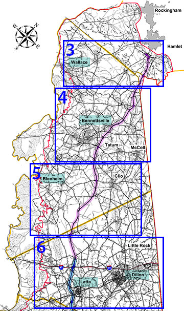
The Selected Alternative, as approved in the Record of Decision, is shown in the map (figure 1). This map uses the County road maps in the Study Area. You can explore specific map details by clicking on the relevant link listed under the Maps section for your area of interest.
Maps
List numbers correspond with numbers on the I-73 North Selected Alternative map (figure 1).
Legend
- Right-of-Way Limits
- 2,500 Foot Study Corridor
- Study Area Boundry
- County Line
- Southern Project Selected Corridor
I-73 North Selected Alternative
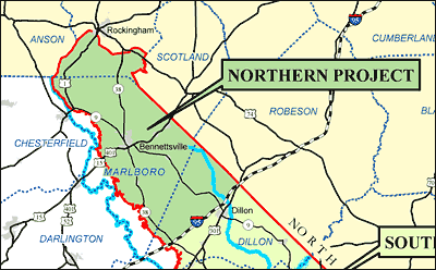
Northern Project Study Area
The Northern Project study area follows the Great Pee Dee River to Interstate 95, travels along Interstate 95 up to the South Carolina/North Carolina state line, and runs along the state line back to the Rockingham/Hamlet, North Carolina area. The study includes a part of North Carolina in this Rockingham/Hamlet area from Interstate 74 south to the state line. This study area is shown in the Northern Project Map.